


1st United Methodist Church, Etowah County, Alabama
About
Outline

Summary
| Unique Area Identifier | 521761 |
| Name | 1st United Methodist Church |
| County | Etowah County |
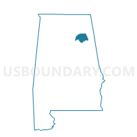
| State | Alabama |
| Area (square miles) | 5.28 |
| Land Area (square miles) | 5.27 |
| Water Area (square miles) | 0.01 |
| % of Land Area | 99.79 |
| % of Water Area | 0.21 |
| Latitude of the Internal Point | 34.02002370 |
| Longtitude of the Internal Point | -86.09154930 |
Maps


Graphs
Select a template below for downloading or customizing gragh for 1st United Methodist Church, Etowah County, Alabama


Neighbors
Neighoring Voting District (by Name) Neighboring Voting District on the Map
- Attalla Recreation Center, Etowah County, AL
- Cave Springs Community Center, Etowah County, AL
- Elliott Community Center, Etowah County, AL
- Reece City Town Hall, Etowah County, AL
- Ridgeville Town Hall, Etowah County, AL
- Walnut Park Recreation Center, Etowah County, AL
Top 10 Neighboring County Subdivision (by Population) Neighboring County Subdivision on the Map
Top 10 Neighboring Place (by Population) Neighboring Place on the Map
Top 10 Neighboring Unified School District (by Population) Neighboring Unified School District on the Map
- Etowah County School District, AL (60,417)
- Gadsden City School District, AL (36,856)
- Attalla City School District, AL (6,048)
Top 10 Neighboring State Legislative District Lower Chamber (by Population) Neighboring State Legislative District Lower Chamber on the Map
Top 10 Neighboring State Legislative District Upper Chamber (by Population) Neighboring State Legislative District Upper Chamber on the Map
Top 10 Neighboring 111th Congressional District (by Population) Neighboring 111th Congressional District on the Map
Top 10 Neighboring Census Tract (by Population) Neighboring Census Tract on the Map
- Census Tract 102, Etowah County, AL (5,518)
- Census Tract 104.02, Etowah County, AL (5,504)
- Census Tract 4, Etowah County, AL (3,866)
- Census Tract 103, Etowah County, AL (2,918)
- Census Tract 9, Etowah County, AL (2,698)
- Census Tract 101, Etowah County, AL (2,059)
- Census Tract 6, Etowah County, AL (1,964)
- Census Tract 5, Etowah County, AL (1,814)